Lauren & Enes' UTV Adventure
Jawbone Canyon, California - April 29th, 2022
|
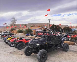
Lauren and Enes arrived at FunTime Rentals at around 9:30AM and we started our adventure a little after 10:00AM. We headed out and took SC175 over to LA2 and stopped at the Bishops' Claim. This was an easy section to make sure Lauren & Enes were comfortable navigating the UTV.
After paying our respects to the Bishops, we headed out towards Dove Springs via SC99 and then SC171. I took them down a short but steep downhill (our first technical section) to see how they did. Once down we followed SC176 which is a sand wash that twists and turns through a canyon. We turned right and took SC124 which dropped us down onto SC103 which took us directly to the actual Dove Springs. |
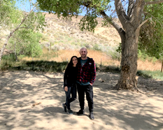
We stopped at Dove Springs and took about a 15 minute break before heading out towards Frog Springs using SC328 and SC47.
Frog Springs is a spring in Kern County and has an elevation of 3999 feet. It is a place where water flows naturally out of the ground. The trail over to Frog Springs is very cool. It is actually below the surrounding desert floor and is lined with Joshua Trees on both sides. It's about a 4 mile ride over to Frog Springs and the double wide trail winds its way down the canyon with many twists and turns. This is a really fun section to explore.
Frog Springs is a spring in Kern County and has an elevation of 3999 feet. It is a place where water flows naturally out of the ground. The trail over to Frog Springs is very cool. It is actually below the surrounding desert floor and is lined with Joshua Trees on both sides. It's about a 4 mile ride over to Frog Springs and the double wide trail winds its way down the canyon with many twists and turns. This is a really fun section to explore.
|
After leaving Frog Springs we headed back up SC47 turning left onto SC50. This took us up into the mountains and then dropped us down into a very cool narrow, twisting sand wash SC37. After navigating this section we turned right and climbed a steep hill using SC69. We crested the top and headed down stopping at the hanging rock for a short break and a few photos. We then continued down the narrow trail and eventually merged back onto SC47. We turned left and headed back up the trail until we came to the intersection with SC328. We stayed on SC47 which headed up left and then down into the valley.
We then took SC44 down and through a rocky section before turning left on SC161 which took us North, we turned right on SC120 then left on LA2. We took LA2 over to EP15 where we crossed highway 14. |
|
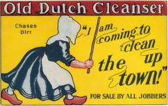
We turned right on Redrock Inyokern road and cruised on this wide dirt road for several miles eventually making a left turn on EP462 and took that to the old Dutch Cleaner Mine. After exploring a few chambers on this talc mine we got back into our UTV's and went back down EP462 turning right onto Sierra View road. We took that North until it merged in with Hart's road EP15 and turned East. Next we checked out the Holly Ash Mine which is similar to the Dutch Cleanser Mine but the chambers do not connect. To save time we took a quick gander and continued East taking the Bonanza Trail. This was the path the gold seekers used to the mines in the sierras then upon returning tried find their fortunes here. The area was so populated that a post office was established in the 1930’s to serve the miners in the area.
|
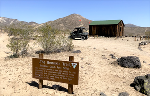
I this point I let Lauren and Enes take the lead so that I could get some video of them from the rear. We took a rocky downhill trail and turned left at the bottom and stopped at the Bonanza Post Office to take another picture. We then turned right and took EP15 down the canyon riding past a few deserted miners cabins. These old cabins are available on a first come first serve basis. At the bottom, we turned left onto EP30 and took a short ride over to Bickel Camp. This was our lunch stop and we took some time to explore Walt Bickel's camp and use the only real outhouses we found on this adventure but they were pretty disgusting so we passed. After eating lunch and exploring the camp, we got back into the rigs and decided to head over to upper Last Chance Canyon since it was getting late and I wanted to make sure we returned the rental by 4PM. Upper Last Chance Canyon is a cool sand wash that winds below the Red, Green, and Brown cliffs of Red Rock Canyon State Park. After a couple miles I led them up into the mountains and we crossed a rocky trail over to Pleasant Valley Road (dirt). This section took us down towards lower Last Chance Canyon and provided really nice views of the colored cliffs. When we got to lower Last Chance Canyon, we turned right and crawled over to Cudahy Camp. If we had turned left, we would have gone down the very technical section of Last Chance Canyon. This is a popular spot for Jeeps and UTV's. In fact as we continued past Cudahy Camp we encountered about 10 jeeps who were headed down to the rock crawling section. After we let the Jeeps pass, we entered the narrow but very pretty section of the trail which was right up against the red rock walls of the canyon.
|
We made a sharp left turn and climbed out of Last Chance Canyon and started our way up the mountain using a narrow trail that at the top was a white chalk-like surface. To exit this trail required a steep right, left, right turn and we all managed to avoid the cliff on the left. Had we gone straight at the bottom and not made the left to climb out of Last Chance Canyon, we would have encountered Graduation Hill. This is a very steep rock climb with a couple large stairsteps. While doable on a UTV, it is mostly attacked with experience Jeep drivers.
|
|
Once we exited the trail we turned left and followed the ridge line that provided some nice views of Dove Springs and Jawbone Canyon off to the right and the El Paso Mountains on the left. This took us on top of another chalk hill which required a sharp right turn to head down into a twisting sand wash and then a left turn and a steep climb up a rocky trail. This trail took us past several mines and eventually came to a smooth twisting trail that ended up at the paved Redrock Randsburg Road. I let Lauren and Enes drive again so they could enjoy the easy fast trail without having to eat my dust. At the paved road I had planned to cross it and then follow the railroad tracks back towards highway 14. I noticed a trail that was on the North side of the road and decided that we should take that instead....Bad choice, after a mile or two the trail ended and there was a fence line that kept us from crossing the highway. So, we headed back and instead of crossing the road and taking the trail I had planned, since it was getting late, I decided that we would drive on the shoulder of the road for a few miles to save some time. When we got close to highway 14, we crossed Redrock Randsburg road and found a trail that took us directed across from Funtime Rentals. We crossed highway 14 at that spot and made it back around 4PM.
|
I really enjoyed meeting Lauren and Enes and I hope they enjoyed their UTV Adventure and will share this page and links with their friends and family.
