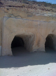
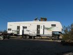
 Our Dove Springs Camp
Burro Schmidt Tunnel
On this trip I was joined by my riding buddies (Pete, Larry, and Jesus) and we camped in Dove Springs, just West of Highway 14 and North of Red Rock Cyn. Be sure to check out the YouTube video embedded further down on the page. Pete narrated the ride and it is pretty funny. I arrived at the campsite around 8am unloaded the toys, set up camp, and went out for a short ride by myself around 11am. I wanted to test my new helmet cam (Drift HD) which is a self contained unit and much easier to use then by old lipstick camera / MiniDV setup. I have since upgraded to the newest Drift Ghost which I believe is better than the more popular GoPro. I decided to ride into the El Paso Mountains and visit the Old Dutch Cleanser Mine, Bickle Camp, and take a short loop on the Bonanza Trail.
On this trip I was joined by my riding buddies (Pete, Larry, and Jesus) and we camped in Dove Springs, just West of Highway 14 and North of Red Rock Cyn. Be sure to check out the YouTube video embedded further down on the page. Pete narrated the ride and it is pretty funny. I arrived at the campsite around 8am unloaded the toys, set up camp, and went out for a short ride by myself around 11am. I wanted to test my new helmet cam (Drift HD) which is a self contained unit and much easier to use then by old lipstick camera / MiniDV setup. I have since upgraded to the newest Drift Ghost which I believe is better than the more popular GoPro. I decided to ride into the El Paso Mountains and visit the Old Dutch Cleanser Mine, Bickle Camp, and take a short loop on the Bonanza Trail.
|
I left camp and headed East down SC94 which is the main dirt road into Dove Springs. I crossed Highway 14 and headed toward Opal Cyn. I continued North past the right turn into Opal Cyn and onto Sierra View Rd. This is a double wide jeep road which is a little rocky in some places but still rated "very easy". After a few miles took a right turn and headed East towards the Old Dutch Cleanser Mine. This Jeep road is very easy and dead ends at the entrance of the mine. Check out my GPS page to download this track or take a look at this simple map. This is a very cool talc mine and fun to explore. The many chambers all link together and the temperature inside is a good 20 degrees cooler. After a short stop at the mine I back-tracked to Sierra View Rd and
continued North until it merged with EP 15. I headed East on EP15 for a couple more miles and came to the area around the Holly Ash Mine. I decided not to visit the mines since I knew I would be back here tomorrow with the boys. If you continue on EP15, it turns right and drops down into Last Chance Cyn. If you look to your left you should see the Bonanza Trail marker. I headed NE and started down the trail. This is a rocky double-wide trail that has a steep downhill ending at the old Bonanza Post Office. Just
|
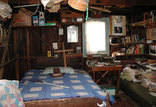
past the Post Office on another spur of EP15 the trail heads down to the right and snakes through a narrow canyon with old cabins scattered along the route. You can see pictures of them by clicking on them. Bonanza Post Office link above. It looked like several of these cabins were still populated. This trail changed from rocky hardpack to sand wash several times. It was pretty easy and lot's of fun. Simple enough to get up some speed but it had interesting parts that made it a little challenging. When you get to the bottom, it intersects with the main EP15 trail (Last Chance Canyon). If you turn right you will head down the canyon and pass the big Highway 14 sign that points to the right. Taking that route will double you back towards the Holly Cleanser Mine. If you pass the Highway 14 sign and continue straight down the canyon, it will eventually drop you down into the lower section of Last Chance Cyn which is very pretty but rocky and not suggested for beginners. I decided to turn left and head towards Bickle Camp. If you have never been to Bickle Camp I suggest you make it a destination for your next visit to the El Paso mountains. The caretaker is happy to provide a history of the area and even a tour of the camp. Donations are appreciated as that is how the camp is maintained. I passed by the camp and continued up EP30, a twisting double wide sandy trail until it again intersected with EP15 & EP26. I followed EP26 North until I came to Colorado Camp. I turned around at this point and head towards Mesquite Cyn Rd (EP100). I knew the trail up to the Walsh Cabin started somewhere off of EP100. Unfourtunatley I took a wrong tunr and headed up a narrow canyon which dead-ended after a couple miles. At this point I figured that I should return to camp and wait for the rest of the gang to arrive. I could then plot a route on my GPS and get to the cabin tormorrow. My trip back pretty much followed EP15 back into Last Chance Cyn, I followed the Highway 14 sign up toward the Holly Ash Mine and the start of the Bonaza Trail. I continued West until I came to the intersection with Sierra View Rd. I turned left and after about 5 miles I was at the Highway 14 crossing. Another 1/2 mile and I was back at camp.
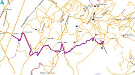 Click to enlarge a map of this ride
The next day we left camp around 10am and headed into the El Paso's. This time we dropped down into Opal Cyn and then climbed up a very rocky double wide jeep trail high into the mountains. I had discovered this route earlier in the year on a trip I took (alone) to scout out the area. While it is much harder than taking Sierra View Rd, it is doable for the average intermediate rider. The views are fantastic with the mountains changing colors around just about every turn. At the top of the last rocky climb the trail descends along the side of a steep cliff and presents a couple small waterfall drop-offs which can be handled easily if you keep your speed up and your weight back. At the bottom of the downhill the trail traverses across a ridge and then climbs up onto a solid rock overlook. You need to turn left and go down the face of this rock were you will meet up with the trail again. Turn left and you will snake through a beautiful section of the mountains. Enjoy this section because the only really difficult section is coming up fast. After about a mile the trail climbs up the side of a hill and comes to a section that presents a little bit of a challenge. You have two options, straight across the face of a off-camber solid rock with about a 1 foot deep cut-out that you will need to cross, or turn right and go down a soft off-camber trail along the cliff that turn left after about 50 feet. This trail then crosses a small culvert with a very steep soft incline that requires you stay forward on the bike and keep your RPM's up. At the top the trails merge and continue East across the ridge for another few hundred yards. Now you come to a very narrow steep twisty rocky downhill that turns about every 10 feet. The quad was almost too wide with my nerf bars but I managed not to get stuck. In this section there is really no stopping. You just need to stay focused, pick your route around the big rocks, and go for it. At the bottom you will come to a 3 foot deep, 4 foot wide gully that requires you drop down in, lean forward, and gas your way up the other side. No problem! Once down you will be in a wide rocky sand wash, turn right out of the gully and head South down the wash. This trail drops in and out of the wash for about a mile or so then intersects with a narrow deeper sand wash on the left. Take that turn and follow that wash for about a mile until you see a jeep trail coming out on the right. Follow that jeep trail for several miles up a twisting narrow canyon. This section is really fun. At the top you will come to an overlook that provides a great view of the El Paso Wilderness.
|
|
If you look right at the top of the ridge you will see the ORPHAN ANNE Mine. Take the trail down and then turn right for the short ride up to the mine. This is a great spot for your first break of the day. After our beer break we headed back down to the trail, turned right and proceeded toward the Burro Schmidt Tunnel. This 2,000-foot long tunnel, approximately seven feet in diameter, was chiseled through a mountain by William Henry Schmidt with hand tools and explosives. Begun in 1906 as a means of transporting ore from his mine to the processing site, Schmidt devoted the following 32 years of his life to digging the tunnel, apparently losing interest in his mining enterprise, until he broke through the mountainside on the other end.
|
Pete leads us to the Burro Schmidt Tunnel (Funny)
